


Plan De Paris
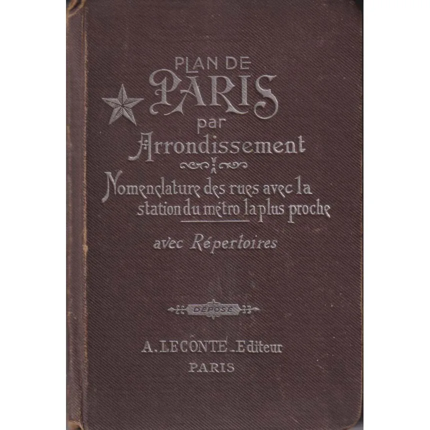
Publisher: A Leconte
Format: Hardback
ISBN: none
Plan de Paris (c.1949) – A. Leconte
A. Leconte, Paris | ISBN: None
Condition: Good | Sold by Crappy Old Books
Paris. The City of Light. A magnificent collection of grand boulevards, romantic cafés, historic monuments and approximately seventeen thousand opportunities to take a wrong turning while confidently assuring one’s travelling companions that the Eiffel Tower is definitely just around the corner.
Welcome to Plan de Paris, a charming vintage street atlas published by A. Leconte, dating provisionally to around 1949, when the French capital was recovering from the upheavals of the Second World War and preparing to resume its traditional occupation of being considerably more stylish than everywhere else.
This delightful little volume presents Paris arrondissement by arrondissement, offering detailed street plans, an alphabetical street directory and references to the nearest Métro stations.
It was, in effect, the Google Maps of its day, although considerably more elegant and unlikely to announce that you should make a U-turn in the middle of the Champs-Élysées.
The cover proudly declares Plan de Paris par Arrondissement, promising the reader a methodical route through the city’s famously complicated geography. The accompanying street nomenclature and Métro references provided the essential tools for navigating Paris before smartphones, satellite positioning and the modern expectation that a little blue dot should follow us everywhere.
There is something wonderfully satisfying about a proper city atlas. Streets must be identified, distances considered and routes planned using nothing more sophisticated than eyesight, common sense and the occasional helpful Parisian.
Admittedly, the last of these was not always guaranteed.
The late 1940s were a fascinating period in Parisian history. German occupation had ended only a few years earlier, post-war reconstruction was underway, and the city was rediscovering its cultural confidence. Existentialist philosophers populated the cafés, artists pursued new ideas, and ordinary Parisians continued the important national tradition of looking faintly disappointed with the rest of humanity.
For today’s collector, a street atlas from this period offers considerably more than navigational assistance.
It provides a geographical snapshot of a city before decades of urban redevelopment, changing transport arrangements and the relentless demands of modern tourism transformed portions of its landscape.
The arrondissement system remains familiar, but the historical details reveal a Paris belonging to a different generation.
The original brown cloth-style cover, with its decorative silver lettering and distinguished vintage typography, possesses an appeal entirely absent from modern disposable tourist maps. This is a book designed to be carried, consulted and retained, rather than discarded at the airport.
Condition: Good. The cover shows age-related wear, particularly around the edges and spine, but retains its wonderfully evocative period appearance. A handwritten “49” inside suggests a date of 1949, although the precise publication year remains unconfirmed.
Offered by Crappy Old Books, this is an appealing acquisition for collectors of vintage maps, lovers of Paris, cartographic enthusiasts and anyone fascinated by the changing appearance of Europe’s great cities.
A charming survivor from an era when exploring Paris required a paper map, comfortable shoes and sufficient linguistic confidence to ask directions without accidentally ordering three kilograms of cheese.
Because getting lost in Paris has always been part of the pleasure.
And with this little atlas, you can experience the additional satisfaction of getting lost in approximately 1949.
Without your telephone telling you that you have arrived.
Keep browsing: See more Travel books Other books by A Leconte
